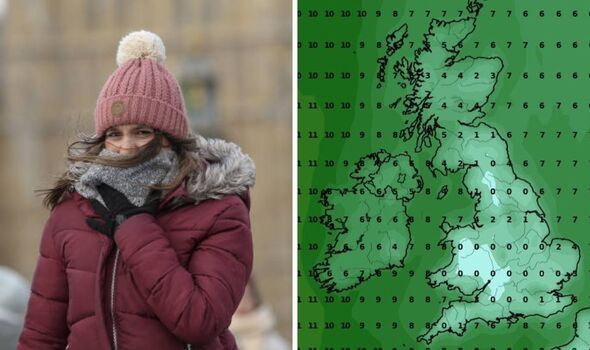
The UK is preparing for the end of the current warm weather as temperatures are soon due to shoot down across England and Wales. The country is currently experiencing a welcome break from the rain and cold its used to, in some areas last week.
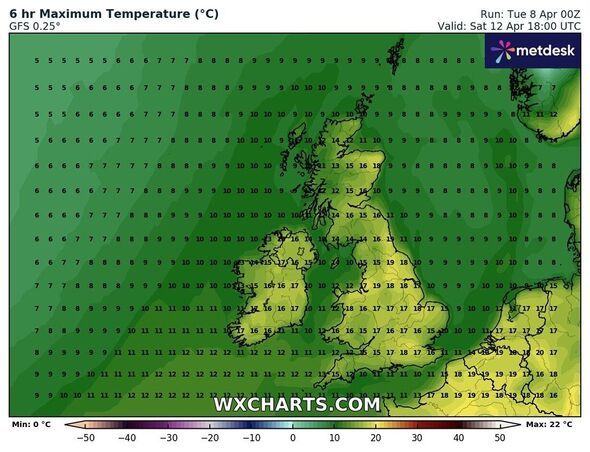
New maps by WXCHARTS, which uses MetDesk data, have revealed that another hot weekend is on the cards as places in the Midlands and North East reach 19C. Separately, the has predicted that London will reach 22C on Saturday after the capital city was hotter than Ibiza, Rhodes and Cyprus last weekend. However, WXCHARTS has also revealed that these summery in the next fornight.
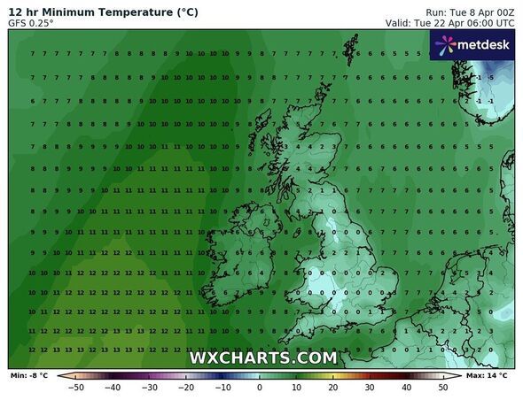
On April 22, by around 20C as the wintry weather comes back.
Many areas of the country will reach 0C, from Plymouth in the South West to Newcastle in the North East.
Other cities that can expect similar lows are: Southampton, Cardiff, Birmingham, and Manchester.
Elsewhere, Norfolk and Suffolk are due to see the highest temperatures, which will range between 2C and 4C.
Separately, the long range weather forecast for April 22 to May 6 reads: "Some unsettled weather is possible at this start of this period with showers or longer spells of rain in places.
"However, a change to more settled conditions is most likely during the latter part of April with high pressure becoming more dominant.
"This settled theme continues into early May, although some spells of wetter, unsettled weather remain possible, especially in the south. Temperatures are expected to be above average overall."