Advanced weather modelling maps show snow looks set to fall across a 500-mile stretch of the UK one day next week.
The has already warned conditions in the UK are expected to turn colder in the coming days. A yellow Cold Alert has also been issued for south-east and parts of northern England, lasting until next Tuesday.
WXCharts maps using the GFS weather model suggest Tuesday could bring to millions of Brits. The flurries are expected to start overnight and in the early hours, hitting areas from the south coast of England to the far north of . Although the data suggests this initial snow won't be very intense, the rate of snow fall is expected to grow throughout the early morning.
READ MORE:
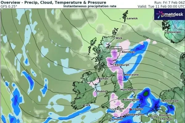
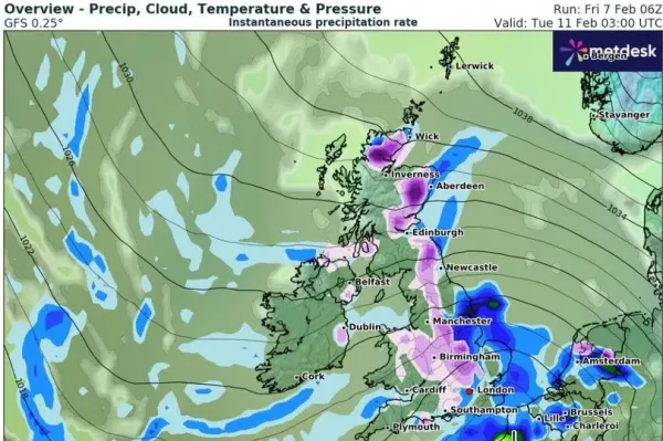
By 3am, the maps show snow falling at a rate of around 1cm per hour in parts of northern Scotland. The Midlands could see rates of around 0.6cm per second. Snow is also expected in the Greater area as well as and .
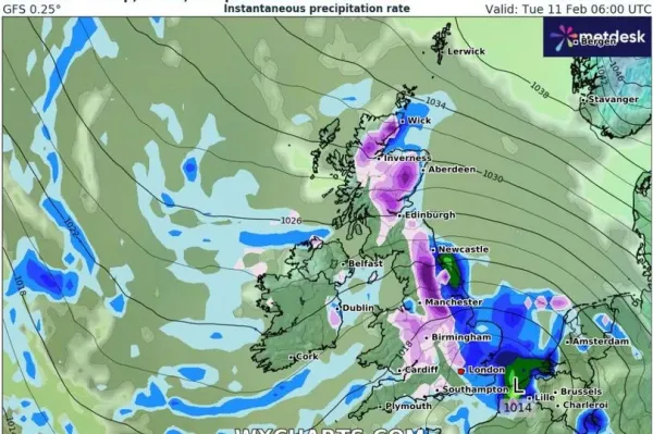
Weather maps for 6am on Tuesday show the more intense snowfall will move southward, leaving Scotland and impacting people living in England. In Yorkshire and the Pennines, snow could be falling at a rate of around 1cm per hour. And lighter snow can be expected still in the Midlands and Greater London. Most of the snow away from the Scottish Highlands should dissipate by the afternoon.
The Met Office has told Brits to expect "some hill snow at times" on Tuesday. It states for the rest of next week: "High pressure is expected to be slow moving and centred to the northeast of the UK at the start of this period. As a result, east or southeasterly winds will dominate, these bringing below-normal temperatures across the UK from mainland Europe. Some rain and hill snow is likely at times, particularly across the east of the UK, with the best of any sunny periods probably in the west."
Weather states for Tuesday: "Tuesday will start bright in the north but soon cloud will spread in from the south. Showers in places, possibly wintry."